Documentary Sources
Documentary sources indicate that the Prescot Street site lay under fields during the Medieval period. The site was not near any known road or settlement area, and the major routes in and out of London lie further to the north and south of the site; Whitechapel Road and the Highway. The site is known from a number of post – Medieval maps dating from the 16th century, which can give an impression of the activities in the area in the past 500 years.
16th Century
Braun and Hogenberg’s map of London showing the site to be in open fields.
The earliest image of the area is shown in the Braun and Hogenburg map of 1572, which shows the site to be fields.
John Stow describes the density of settlement along Whitechapel Road in the 16th century:
That street is not only fully replenished with buildings outwards, and also pestered with divers alleys, on either side to the bars, but to White Chappell and beyond
(Stow 1956, p.116)
17th Century

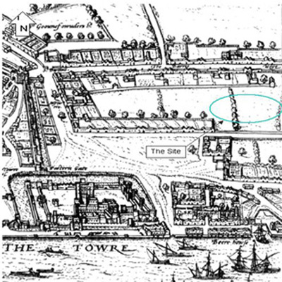
Faithorn and Newcourt map 1658. The Prescot Street site is marked with an X.
The area around Spitalfields and Whitechapel was the worst hit in London during the 1665 Great Plague. Faithorn and Newcourt show the Prescot Street site as open fields in their survey dating to 1658. The buildings along Whitechapel Road to the north of the site are also illustrated to add to John Stow’s description above. The main road to the south of the site is also lined with large houses with gardens. In effect the site is in an open field surrounded on three sides by linear development along main roads.
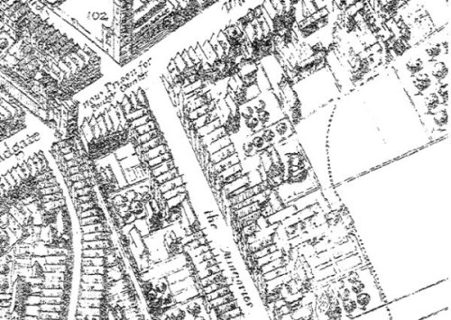
Detail from Leake’s survey of the City of London after the Great Fire 1667
John Leake’s survey of the City of London following the Great Fire indicates that the site is open land and that the suburban development around the site has not been burned by the fire. The survey is more detailed than earlier work and some minor differences in the layout of the plots in the area of the site may be explained by either improved survey detail or minor changes in the land organisation of the area.
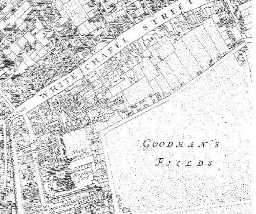
Detail from Morgan’s Map of the Whole of London in 1682
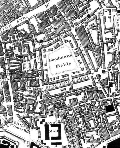
By the time of William Morgan’s survey of 1681 the area around the study site is less rural in character and increasingly suburban. Goodmans Fields remains as an open field although it looks increasingly like a remnant of cut off farm land. A large number of Irish people, many working as skilled weavers, were settled around the Tower of London in an area known as Knockfergus, which appears on John Rocque’s map below. Knockfergus is a slang name given to the area around Hog Lane and Rosemary Lane, where cheap shoddily built housing had been erected for multiple occupation. This road is now known as Royal Mint Street. It is likely that these settlers were refugees from the effects of the Nine Years War in Ulster, as Knockfergus is the old name for Carrickfergus in Ulster.
18th Century
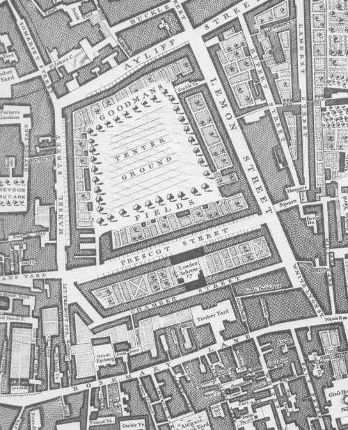
John Rocque 1746
John Rocque’s map below shows the continuing development of the area. The city has expanded rapidly and many of the buildings in Minories and Rosemary Lane have taken on a more industrial character. The area had been populated by Huguenot refugees since the late 17th century, especially around Spitalfields. A large number of these French immigrants were silk weavers or importers and settled in the Spitalfields area. The Huguenots became very wealthy and large houses were built in the area. The tenter grounds were used by weavers and cloth makers to stretch the cloth after it had been woven. Irish silk weavers followed shortly after and the two communities didn’t always get on. In the 1760’s, there was a general downturn in the weaving industry as imports from India and China pushed prices down. Silk weavers were notorious for unionising and protesting violently on occasion. They would rip the calico from ladies garments in the streets in protest against the import of cotton that threatened the silk weaving industry. In 1769, these protests decended into riots, when a meeting of weavers at the Dolphin pub in Spitalfields was raided by soldiers, and two weavers were killed in the process. This was known as the Spitalfields Riot. In November 1763 the weavers:
in riotous manner broke open the house of one of their masters, destroyed his looms, and cut a great quantity of silk to pieces, after which they placed his effigy in a cart, with a halter about his neck, an executioner on one side, and a coffin on the other; and after drawing it through the streets they hanged it on a gibbet, then burnt it to ashes and afterwards dispersed
Gentleman’s Magazine 1763
19th Century
Greenwood & Co – Extract from map of London 1827
Christopher and John Greenwood’s map of 1827 still has the tenter ground marked and although at a small scale, it is possible to notice that the site has seen little additional development. The gardens of the houses fronting Prescot Street are still gardens and it would seem reasonable that the area remained well-to-do if not actually wealthy. Some structures can be seen in a few of the gardens although it is unclear if these are sheds, stables or dwellings of some kind.
Ordnance Survey map 1873
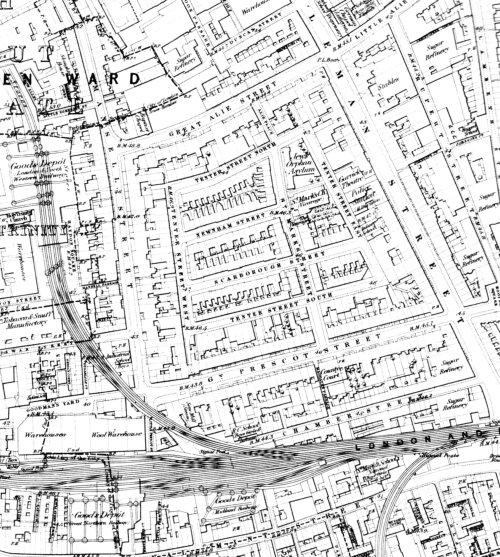
The 1873 Ordnance Survey map shows that several large goods yards have been constructed in the area of the Prescot Street site to connect with the docks. The tenter ground, which was a last remnant of open ground in the area, has been divided up and developed as a series of smaller streets containing small houses presumably built to house the growing workforce of the area.
20th Century
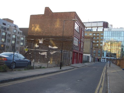
Buildings on the Prescot Street site that stood until 2007
The site remained largely unchanged through the 1913 edition of the Ordnance Survey right up to the 1940 edition. During the Second World War, the area, situated so close to the docks and between 2 large goodsyards, suffered quite badly from bombing.
The first post-war survey shows the extent of bomb damage with several of the buildings on site marked as ruins. By 1968, much of the site has been cleared as buildings make way for car parking. The redevelopment of the area in the post war period including the construction of the ring road has a profound effect on Prescot Street, transforming it from a residential street into a major thoroughfare for modern traffic. The buildings in the image above that stood on the site at Prescot Street until 2007 survived the Second World War.
- Author: Lorna Richardson |
- Nov 13, 2007
- Share