Close to the End
- By: Gregory Crees |
- Sep 25, 2008
- Share
- del.icio.us

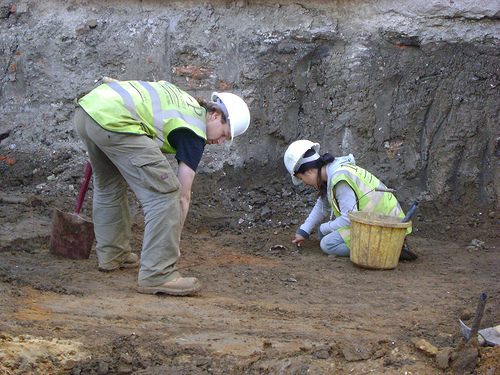
Back on ‘heavy’ duties, and I’ve been involved with the excavation of a number of pits including a couple of inhumations, with the assistance of Liz. The burials were aligned East-West Context: 1813 and North-South Context: 1858, so possibly represent different phases of the cemetery. Both were being cut by, and in turn cutting, some large quarry (?) pits. Both were well preserved.
As far as the pits are concerned, the most interesting was Context: 1931 which contained some disarticulated bones of a (disturbed) burial and also cutting through these bones, was a linear feature Context: 1922. It ran in a South-West to North-East direction. Unfortunately, it runs off into the limit of excavation, so its full extent cannot be ascertained, but it would be interesting if it can be identified (maybe at a later stage) as a beam slot foundation. Interestingly, if my memory serves me well, it seems to follow a roughly parallel direction of a feature previously dug by Ruth some time ago, that was itself identified as a beam slot Context: 1406. I’m not suggesting it is directly related to that other feature, but it would be interesting if it follows the same direction. This would imply a continuity in the layout or in usage of the cemetery area – e.g. structures (like for instance a mausoleum) or buildings that, despite being built in different areas of the site, follow along the same line of direction – suggesting the existence of, for example, a path or road running through the area. One for post-ex, maybe…
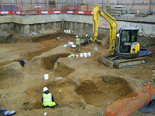
The far East end of site
Talking of limits of excavation, it is also a little sobering to record features running beyond the large concrete slab that is the ultimate end of the site limit, and which reminds me that we’re getting closer to the end of the excavation (and of my job!).
Just need to find a big Roman mosaic or something…